skip to main
|
skip to sidebar
Walk Walk
Been There - Seen That
FAMOUS PLACES AND POPULAR TOURIST DESTINATIONS WE HAVE BEEN TO
[Places To See Before You're Too Old]
%%%%%%%%%: May Peace Be Upon You :%%%%%%%%%
&&& "enjoy your visit" &&&
24 January 2022
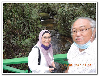
Driving from Kinabalu Park to Kota Kinabalu
Back to Kota Kinabalu
Sunday 23rd January 2022
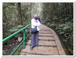
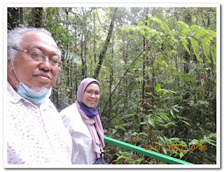
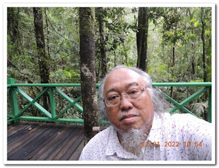
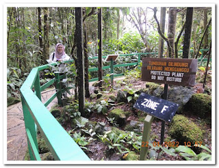
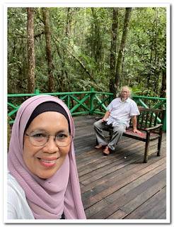
Mount Kinabalu National Park
Kundasang, Sabah
Sunday 23rd January 2022
Older Posts
Home
Subscribe to:
Posts (Atom)
Holiday to Ranau, Kundasang, Mesilau and Kota Kinabalu, Sabah : 21st to 26th January 2022
Driving from Shah Alam to KLIA
Flying Out of KL International Airport
Flying from KLIA to Kota Kinabalu Airport
Flying Into Kota Kinabalu International Airport
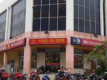
Driving from KK Airport to Tamparuli
Rumah Terbalek, Tamparuli
Driving from Tamparuli to Sabah Tea Plantation
1 Nite here at Sabah Tea Plantation Resort
Sabah Tea Plantation, Ranau, Sabah
Sabah Tea Plantation, Ranau, Sabah
Driving from Sabah Tea to Kundasang
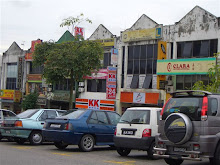
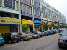
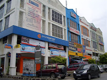
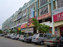
Kundasang Town [in the morning]
Pasar KRT Kundasang
Kundasang Town [in the afternoon]
Driving from Kundasang to Mesilau
Mesilau Strawberry Farm
1 Nite here at H Benjamin Residence [arrival]
1 Nite Here at H Benjamin Residence [departure]
Driving from Mesilau to Kinabalu Park
Mount Kinabalu National Park
Driving from Kinabalu Park to Kota Kinabalu
Holiday to Tanjong Jara Resort : 09th to 12th January 2022
On Grab from Subang Airport to Shah Alam
Flew Into Sultan Abdul Aziz Shah Airport
Flying from Trengganu Airport to Subang Airport
Flew Out of Trengganu Airport
Driving from Tanjong Jara Resort to TGG Airport
Day 4 at Tanjong Jara Resort
Day 3 at Tanjong Jara Resort
Jeti Seberang Pintasan, Dungun
Teluk Bidara, Dungun
By the Beach and Pool of Tanjong Jara Resort
Jeti Nelayan Dungun, Trengganu
Around Dungun Town
Day 2 at Tanjong Jara Resort
Early Morning at Tanjong Jara Resort
Sunset at Kuala Dungum, Trengganu
Checking-In into Tanjong Jara Resort
Driving from TGG Airport to Tanjong Jara Resort, Dungun
Flew Into Kuala Trengganu Airport
Flying from Subang Airport to Kuala Trengganu Airport
Flying out of Sultan Abdul Aziz Shah Airport
On Grab from Shah Alam to KLIA
Holiday in Pulau Pinang : 21st to 24th December 2021
n) Driving from KLIA to Shah Alam Home
m) Flying into Kuala Lumpur International Airport
l) Flying from Penang International to KLIA
k) Flying Out of Penang International Airport
j) Driving from G Hotel to Penang Airport
i) Driving Round Penang Island
h) Tan Clan Jetty, Georgetown
g) 3 Nites Here : G Gurney Hotel
f) Chowrasta Penang
e) Driving from Penang Airport to Chowrasta
d) Flying into Penang International Airport
c) Flying from KLIA to Penang
b) Flying Out of KLIA
a) Driving from Shah Alam to KLIA
Pulau Langkawi Holiday : 7th to 10th November 2021
j) Flying Home from Langkawi to KLIA
i) Air Hangat Village, Air Hangat
h) 1 Nite at The Danna
g) 2 Nites at Pelangi Beach Resort
f) 3D Art in Paradise Langkawi
e) Langkawi Sky Cab
d) Flew Into Langkawi International Airport
c) Flying from KLIA to Pulau Langkawi
b) Flying on MH from KLIA to LGK
a) By Grab from Home to KLIA
Nuryanti Flew Home to Indonesia : 17th September 2021
Our Maid of 15 Years Flew Home
Shopping in Pasar Pasir Penambang : 7th January 2021
Lunch at Faridah Mentarang Bakar
Padi Fields of Sekinchan
Pasar Pasir Penambang Kuala Selangor
Driving from Shah Alam to Kuala Selangor
Family Holiday to Kuala Lumpur : 30th December 2020 to 1st January 2021
Photos From Mama's Handphone [2 of 2]
Photos From Mama's Handphone [1 of 2]
Driving Home after the Holiday
Lunch : Dolly Dimsum Avenue K, Kuala Lumpur
Dinner : Nasi Lemak Wanjo, Kampong Baru
Pintasan Saloma, Kuala Lumpur
Day One at Traders Hotel Kuala Lumpur
Driving from Shah Alam to Kuala Lumpur
Family Holiday to Pulau Pangkor : 19th to 22nd December 2020
Photos from Mama's Handphone [2 of 2]
Photos from Mama's Handphone [1 of 2]
Driving from Marina Island to Shah Alam
Marina Island Jetty Terminal Teluk Muruh
Ferry from Pangkor Jetty to Marina Island
Pangkor Jetty, Pulau Pangkor
On Hotel Shuttle to Pangkor Jetty
4th Day at AVI Pangkor Beach Resort
Dinner at Coral Bay, Pulau Pangkor
Lunch at Coral Bay, Pulau Pangkor
Back From the Sea
Pulau Giam, Pulau Pangkor
Day Out to Sea
3rd Day at AVI Pangkor Beach Resort
Dinner at Coral Bay, Pulau Pangkor
Pekan Pangkor, Pulau Pangkor
Pantai Pasir Bogak, Pulau Pangkor
2nd Day at AVI Pangkor Beach Resort
First Day at AVI Pangkor Beach Resort
On Taxi from Pangkor Jetty to AVI Hotel
Arrived Into Pangkor Jetty Ferry Terminal
On Ferry from Lumut to Pulau Pangkor
Marina Island Jetty Complex Lumut
Driving from Shah Alam to Marina Island Lumut
Golf Outing to Port Dickson : 28th and 29th September 2020
Driving from Port Dickson to Shah Alam
Golf at Dickson Bay Golf Resort, Port Dickson (29SEP)
Golf at Dickson Bay Golf Resort, Port Dickson (28SEP)
Driving from Shah Alam to Port Dickson
Holiday to Pangkor Laut Resort : 14th to 17th September 2020
Photos from Alla's iPhone [5 of 5]
Photos from Alla's iPhone [4 of 5]
Photos from Alla's iPhone [3 of 5]
Photos from Alla's iPhone [2 of 5]
Photos from Alla's iPhone [1 of 5]
Driving Home from Bandar Sekinchan
Pit Stop at Bandar Sekinchan
Driving from Marina Island to Sekinchan
Ferry from Pangkor Laut Island to Marina Island
Day 4 at Pangkor Laut Resort
Day 3 at Pangkor Laut Resort
Day 2 at Pangkor Laut Resort
Emerald Bay : Pangkor Laut Island
The Pool at Pangkor Laut Resort
Day 1 at Pangkor Laut Resort
Hill Villa at Pangkor Laut Resort
Ferry from Marina Island to Pangkor Laut Island
Marina Island Jetty
Driving from Shah Alam to Marina Island
Golf Outing to Genting Highlands [9th and 10th September 2020]
Driving from Genting Highlands to Shah Alam
Golf at Awana Genting Highlands Golf and Country Resort
Golf at Awana Genting Highlands Golf and Country Resort
Driving from Shah Alam to Genting Highlands
Golf Buddies Outing to Malacca [1st and 2nd September 2020]
Golf at Ayer Keroh Country Resort
Golf at Tiara Melaka Golf & Country Club
Driving from Shah Alam to Ayer Keroh
Alla's Family Holiday to Port Dickson [29th Aug to 1st September 2020
Driving from Port Dickson to Shah Alam
Admiral Cove, Port Dickson
Driving from Shah Alam to Port Dickson
Johore Golf Tour [24th to 27th August 2020]
Golf at Forest City [Classic Course]
Golf at Forest City [Legacy Course]
Driving from Desaru to Forest City
Golf at The Els Club Desaru Coast (pm)
Golf at The Els Club Desaru Coast (am)
Driving from Shah Alam to Desaru
Cameron Highlands Trip 27th to 29th July 2020
Driving from Tanah Rata to Shah Alam
2 Nites Here : Avillion Cameron
Cameron ValleyTea Plantation
Cameron Lavender
Strawberry Farm
Sungei Palas Tea Plantation [28JUL2020]
Sungei Palas Tea Plantation [27JUL2020]
Cameron Highlands
Hutan Lipur Lata Iskandar
Driving from Shah Alam to Tanah Rata
Golf Outing to Penang 12th to 15th July 2020
Driving from Seberang Jaya to Shah Alam
Ferry Crossing: Penang Island to Butterworth
In Penang Island
Ferry Crossing : Butterworth to Penang Island
Golf at Penang Golf Resort
Golf at Permaipura Golf and Country Club
Golf at Kulim Golf and Country Resort
Driving from Shah Alam to Seberang Jaya
A Day in Sekinchan, Kuala Selangor and Pantai Remis
(02JUL2020) Jalan Jalan West Selangor
Golf Outing to Johore 24th to 26th June 2020
Driving from Forest City to Shah Alam
2 Nites at Forest City Golf Hotel
Golf at Forest City Golf Resort (Legacy Course)
Golf at Forest City Golf Resort (Classic Course)
Golf at Horizon Hills and Country Club
Driving from Shah Alam to Forest City
DRIVING EUROPE : 2012 / 2013 / 2014 / 2015 / 2016 / 2017 / 2018 / 2019 / 2020
FEB & MAR 2020 : Reykjavik to Oslo
JULY 2019 : Berlin to Paris
APRIL 2019 : Paris to Keukenhof
MARCH 2019 : Germany, Austria and Poland
JUNE 2018 : London and Bath
MAY 2018 : Almaty and Moscow
FEBRUARY 2018 : Climbing Austrian Alps
APRIL 2017 : Crossing Switzerland & Keukenhof
MARCH 2017 : Vienna : Bratislava : Istanbul
APRIL 2016 : Holland : Germany : Luxembourg : Belgium : Holland
SEPTEMBER 2015 : Vienna : Budapest : Prague : Bad Hofgastein : Salzburg : Linz : Bratislava : Vienna
MAY 2015 : Paris : Luxembourg : Bruxelles : Amsterdam : Keukenhof
JUNE 2014 : Paris : Switzerland : Paris
APRIL 2014 : Holland Only
APRIL 2013 : Spain : Portugal : Spain : Holland
MARCH 2013 : Belgium : France : Luxembourg : Liechtenstein : Austria : Germany : Netherlands : Belgium
SEPTEMBER 2012 : Switzerland : Liechtenstein : Austria : Germany : Italy : Switzerland
APRIL 2012 : Belgium : Holland : Germany : Luxembourg : France : Belgium
KRTU Fun Golf Outing to Miri and Brunei : 10th to 13th February 2020
On KLIA Family Van from KLIA to Shah Alam
Flew into KLIA from Miri Airport
Flying from Miri Airport to KLIA
Flew out of Miri Airport to KLIA
On Bus from Eastwood Valley Golf to Airport
Stayed Here 3 Nites : Meritz Hotel Miri
Golf at Eastwood Valley Golf and Country Club
On Van from Hotel to Eastwood Valley Golf and CC
On Rental Car from Jerudong Brunei to Hotel
Golf at Royal Brunei Golf and Country Club
On Rental Car from Hotel to Jerudong Brunei
On Van from Miri Golf Club to Hotel
Golf at Miri Golf Club, Miri, Sarawak
On Van from Hotel to Miri Golf Club
Tamu Muhibbah Miri
On Van from Miri Airport to Hotel
Flew from KLIA into Miri Airport
Flying from KLIA to Miri Sarawak
Flew to Miri out of KLIA Airport
On KLIA Limo from Shah Alam to KLIA
Dinner Celebrating Abdul Hadi Abdillah : Lala Chong Seafood : Sunday 9th January 2020
Dinner Celebrating Hadi's Promotion
Bangkok, Thailand 13th to 17th January 2020
On KLIA Taxi from KLIA to Shah Alam
Flew Into KLIA International Airport
Flying from Suvarnabhumi to KLIA
Flew Out of BKK Suvarnabhumi
On Grab from Hotel to Suvarnabhumi
2 Nites at I Residence Hotel Silom
Patpong Night Bazaar, Bangkok
On Grab from Jim Thompson to Usman
On Grab from Hotel to Jim Thompson
IconSiam, Bangkok
Special Boat : Sathorn Taksin to IconSiam
Back From Nonthaburi to Sathorn Taksin
Nonthaburi, Thailand
Up River Cruise : Sathorn Pier to Nonthaburi
Sathorn Pier, Bangkok
2 Nites Here : Hotel La D' Tel, Bangkok
Streets of Bangkok
Damnoen Saduak Floating Market
On The Long Tail Boat : Damnoen Saduak
Maeklong Railway Market
On Tour Van to and from Mae Klong
On Taxi from Suvarnabhumi to Hotel in Silom
Flew Into BKK Suvarnabhumi International
Flying From KLIA to Bangkok Suvarnabhumi
Flew Out of KLIA International Airport
On KLIA Limo from Home to KLIA
Family Trip to Jakarta : 25th to 29th December 2019
Stayed Here 4 Nites : Ana Hotel Jakarta
On Grab from KLIA to Shah Alam
Flew Into KLIA International
Flying From Soekarno-Hatta to KLIA
Flew Out of Soekarno-Hatta Internasional
On Grab from Ana Hotel to CGK Airport
On Grab from Menteng Wok Street Food to Hotel
Dinner at Menteng Wok Street Food
On Grab from Hotel to Menteng Wok Street Food
Hi Tea at Ninety-Nine Grand Indonesia
Lunch at Cafe Batawi Plaza Indonesia
Shopping at Thamrin City, Jakarta
On Grab from Taman Mini to Hotel
Istana Anak Anak Indonesia, Taman Mini
Taman Mini Indonesia Indah, Jakarta
On Grab from Hotel to Taman Mini Indonesia
1st of 4 Nites at Ana Hotel Jakarta
On Grab from Ancol Back to Hotel
Sea World Ancol Jakarta
Boat Ride at Ancol Beach
One Morning at Ancol Beach
On Grab from Hotel to Ancol
Dinner : Nasi Goreng Gila Kebun Sirih
Thamrin City Jakarta
On Grab from Airport to Ana Hotel
Flew Into Sukarno-Hatta Internasional
Flying from KLIA to Sukarno-Hatta
Flying Out from KL International Airport
On KLIA Limo from Home to KLIA
University of New Haven Reunion Dinner : Kelab Shah Alam : 14th December 2019
The UNH Reunion Dinner
Wedding Anak Datin Maheran : Wisma PKPS Shah Alam : Saturday 7th December 2019
Wedding Ceremony With Neighbours
Surabaya, Indonesia : 2nd to 6th December 2019
Driving From KLIA to Shah Alam
Flew Into KLIA KUL
Flying From Surabaya SUB to KLIA KUL
Flew Out of Juanda Airport Surabaya
On Grab From Bumi Hotel to Juanda Airport
Stayed Here 4 Nites : Hotel Bumi Surabaya
Lapangan Brawijaya : Pasar Malam Kodam
On Hotel Car from Bangkalan back to Hotel
Goa Pote, Bukit Jaddih, Bangkalan Madura
Suramadu Bridge : Surabaya - Bangkalan
On Hotel Car to Jaddih Hill, Bangkalan Madura
Our GRAB Drivers Last 2 Days
2nd of 4 Nites : Hotel Bumi Surabaya
Pantai Kenjeran, Surabaya
Taman Harmoni, Keputih, Surabaya
Hutan Bambu Keputih, Surabaya
Plaza Tunjungan, Surabaya
By Taxi from Juanda Airport to Hotel
Flew Into Juanda Airport Surabaya
Flying from KLIA to Surabaya
Flying Out of KLIA
Driving From Shah Alam to KLIA
Hunting for Keropok in Kota Bharu : 25th to 26th November 2019
On Grab from Subang Airport to Shah Alam
Flew Into Subang Airport
Flying From Kota Bharu to Subang
Flying Out of Kota Bharu Airport
With Haji Nohasim From Hotel to Airport
One Nite Here : Hotel Perdana Kota Bharu
On Grab from KB Airport to Hotel Perdana
Flying In Into Kota Bharu Airport
Flying From Subang SZB to Kota Bharu KBR
Flying Out of Subang Airport
On Grab from Shah Alam to Subang Airport
KFG Outing to Kuantan : 29th to 31st October 2019
Driving From Kuantan to Shah Alam
Stayed Here 2 Nites : Vistana Kuantan
In Kuantan : During the Golf Trip
Golf at Mahkota Golf & Country Club
Rumah Mak Teh Sarimah Yusof
Golf at Royal Pekan Golf Club, Pekan
Golf at Royal Pahang Golf Club, Kuantan
Driving From Shah Alam to Kuantan
Linda's Lunch Treat at Rebung : 28th October 2019
Lunch at Restaurant Rebung Chef Ismail
Apai's Birthday Dinner : Lisettes Empire Subang : 27th October 2019
Dinner With The Family
Wedding Anak Haji Anasir & Hajah Ruhayah : 20th October 2019
Driving From Bangi Golf Resort to Shah Alam
Wedding Reception Anak Haji Anasir & Hajah Ruhayah
Driving From Shah Alam to Bangi Golf Resort
Golf Buddies Outing to Bangi Golf Resort : 17th October 2019
Driving From Bangi to Shah Alam
Golf at Bangi Golf Resort, Bangi
Driving From Shah Alam to Bangi
Mama's 60th Birthday and Retirement Lunch : Minmax PNB Darby Park : 13th October 2019
Driving From Kuala Lumpur to Shah Alam
60th Birthday and Retirement Lunch
Driving From Shah Alam to Kuala Lumpur
ERASMUS : REPEASEA Meeting Chiang Mai : 5th to 12th October 2019
On Grab from KLIA2 to Shah Alam
Flew In Into KLIA2
Flying From Chiang Mai to KLIA2
Flying Out of Chiang Mai Airport
On Rental Van : Hotel to Chiang Mai Airport
Stayed Here 7 Nites : Duangtawan Hotel
Chiang Mai Night Bazaar, Chiang Mai
Out and About in Chiang Mai
Anusarn Market, Chiang Mai
After the 2nd Nite at Duangtawan Hotel
On Tour Van from Doi Inthanon back to Hotel
Sirithan Waterfall
Wachirathan Waterfall
Royal Argricultural Station Inthanon
Royal Twin Pagodas
Summit Doi Inthanon
White Karen Hill Tribe : Doi Inthanon
On Tour Van From Hotel to Doi Inthanon
Anusarn Market, Chiang Mai
Chiang Mai Night Bazaar
On Hotel Limo from Airport to Hotel
Flew Into Chiang Mai Airport CNX
Flying From KLIA2 KUL to Chiang Mai CNX
Flying Out of KLIA2 : Bound for Chiang Mai
On KLIA Limo From Home to KLIA2
Buying Souvenirs and Pick Up P310 Camera in KL : 3rd October 2019
Driving Home After Souvenirs & Camera
Half a Day in Kuala Lumpur
Central Market
Nu Sentral Shopping Centre
Golf Buddies Northern Tour 4.0 : 24th to 26th September 2019
Driving From Sungai Petani to Shah Alam
Golf at Penang Golf Resort Kepala Batas
2 Nites in Sungai Petani
Bujang Valley Archaeological Museum, Merbok
Golf at Permaipura Golf & CC Bedong Kedah
Golf at Cinta Sayang Resort Sungai Petani
Driving From Shah Alam to Sungai Petani
Erasmus Repesea Meeting Yogyakarta Indonesia : 1st to 7th September 2019
On GRAB From KLIA2 to Shah Alam
Flew Into KLIA2 from Jogjakarta
Flying From Jogjakarta to KLIA2
Flew out of Adisut Jipto Airport Jogjakarta
On GRAB : From Hotel to Jogja Airport
6 Nites Here : Novotel Yogyakarta
Jogjakarta : By the Train Station
ON UII Van From JOG Airport to Hotel
Flew Into Adisut Jipto Airport Yogyakarta
Flying From KLIA to Adisut Jipto Yogyakarta
Flying Out of KLIA2
On Limo From Shah Alam to KLIA2
KFG Golf Outing to Phang Nga, thailand : 24th to 27th July 2019
On GRAB From KLIA to Shah Alam
Arrived Into KLIA on MH791
Flying From Phuket to KLIA
Flying Out of Phuket Airport : To KLIA
Golf at Tublamu Navy Golf Course, Khao Lak
Driving From Briza Beach Resort to Tublamu Golf
1 Nite Here : Briza Beach Resort, Khao Lak
Driving From Khao Sok to Khao Lak
Golf at Rajjaprabha Golf Course, Khao Sok
1 Nite Here : Baandin Chiewlan Resort, Khao Sok
Katathong Golf Resort & Spa, Hotel, Phang Nga
Golf at Katathong Golf Resort & Spa, Phang Nga
Golf at Katathong Golf Resort & Spa, Phang Nga
Driving From Phuket Airport to Katathong
Flew Into HKT Phuket Airport
Flying From KLIA to Phuket
Flying Out of KLIA : to Phuket
On Limo From Shah Alam to KLIa
Bakar Lemang For Aidilfitri : 4th June 2019
Lemang for Aidilfitri 2019
Picking Up Kek Kukus Buah : Ros at Sentul Station : 27th May 2019
Drove Home From Batu 3 Komuter Station
On Komuter : Sentul Station to Batu 3 Station
Picked Up Kek Kukus Buah at Sentul Station
Passed Thru' KL Sentral Station
On Komuter : Batu 3 Station to Sentul Station
Driving From Home to Batu 3 Komuter Station
Picked Up Nikon P310 : 21st May 2019
Picked Up the Used Nikon P310 From Ahmad Dineal
KRTU Fun Golf Outing to Kota Seriemas Golf : 17th April 2019
Driving From Kota Seriemas to Shah Alam
Golf at Kota Seriemas Golf and Country Club
Driving From Shah Alam to Kota Seriemas
Golf Buddies Outing to Kota Seriemas : 26th March 2019
Driving From Kota Seriemas to Shah Alam
Golf at Kota Seriemas Golf & CC
Driving From Shah Alam to Kota Seriemas
ERASMUS : Yogyakarta : 12th to 17th March 2019
By Grab : From KLIA2 to House in Shah Alam
Flew Into KLIA2, Sepang, Selangor Darul Ehsan
Flying From Yogyakarta Adisutjipto to KLIA2
Flew From Yogyakarta Adisutjipto Airport
By Grab : From Hotel to Yogyakarta Airport
5 Nites Here in Yogyakarta, Indonesia
Tamansari Water Castle, Yogyakarta [2 of 2]
Tamansari Water Castle, Yogyakarta [1 of 2]
Out and About Yogyakarta, Indonesia
Plaza Ambarrukmo, Yogyakarta
Out and About Yogyakarta, Indonesia
5 Nites Here in Yogyakarta, Indonesia
Out and About Yogyakarta, Indonesia
Everywhere in Yogyakarta on GRAB
Jalan Malioboro, Yogyakarta [by night]
Malioboro Mall, Yogyakarta
Pasar Beringharjo, Yogyakarta
Jalan Malioboro, Yogyakarta
Mall Galeria Yogyakarta, Indonesia
5 Nites Here in Yogyakarta, Indonesia
By Private Taxi From Adisutjipto Airport to Novotel Yogyakarta
Flying From KLIA2 to Yogyakarta
Flew to Yogyakarta thru' KLIA2
On GRAB From Shah Alam to KLIA2
Golf Buddies Outing to Kuantan : 19th to 21st February 2019
Driving From Kuantan to Shah Alam
Golf at Mahkota Golf and Country Club
Golf at Royal Pekan Golf Club
Golf at Royal Pahang Golf Club
Driving From Shah Alam to Kuantan
KRTU Fun Golf Trip to Langkawi 23rd to 25th January 2019
Flying From Langkawi to Shah Alam
Golf at The Els Club, Teluk Datai, Langkawi
Roaming Pulau Langkawi
Air Hangat Village, Langkawi
Gunung Raya, Langkawi
Nasi Dagang Pak Malau, Langkawi
Dataran Lang, Langkawi
Golf at Gunung Raya Golf Resort
Flying From Shah Alam to Langkawi
AAGBS Family Day at Avillion Admiral Cove : 11th to 13th January 2019
Driving From Port Dickson to Shah Alam
Stayed Here 2 Nites : Avillion Admiral Cove
Driving From Shah Alam to Port Dickson
Viva Voce at UIAM : Norayikin Shaikh Ibrahim : 3rd January 2019
To and From UIAM for Viva Voce
Family Holiday : Pulau Langkawi : 23rd to 26th December 2018
Sri Kijang, Langkawi, Pantai Cenang
Kuala Lumpur International Airport 2
Flying From Langkawi to Shah Alam
Langkawi International Airport
Langkawi, Kedah Darul Aman
Nasi Dagang Pak Malau, Jalan Makam Mahsuri
Langkawi, Kedah Darul Aman
Shopping at HIG Shopping Complex
Dataran Lang, Langkawi
Langkawi, Kedah Darul Aman
On The Boat at Kilim Karst Geoforest Park
Eagles and Monkeys, Kilim Karst Geoforest Park
Pantai Pasir Panjang, Kilim Karst Geoforest Park
Floating Restaurant, Kilim Karst Geoforest Park
Kilim Karst Geoforest Park
Bat Cave
On Arrival Into Langkawi
Kuala Lumpur International Airport 2
Flying From Shah Alam to Langkawi
Mawar's 6th Birthday Party : Jump Street, Section13, Petaling Jaya : 22nd December 2018
Mawar's Birthday Party [2 of 2]
Mawar's Birthday Party [1 of 2]
Golf Buddies Outing to Seri Menanti Golf : 18th December 2018
Driving From Seri Menanti to Shah Alam
I Grew Up Here
Golf at Royal Seri Menanti Golf and Country Club
Driving From Shah Alam to Seri Menanti
KRTU Fun Golf Outing to Ipoh and Penang : 12th to 14th December 2018
Driving From Seberang Perai to Shah Alam
Golf at Mountain View Golf Resort, Seberang Perai
Driving From Penang to Seberang Perai
Golf at Penang Golf Club, Bukit Jambul
Design Village Outlet Mall, Penang
Driving From Ipoh to Penang
Golf at Meru Valley Resort, Ipoh
Driving From Shah Alam to Ipoh
Viva Voce : Putra Business School : 7th December 2018
Candidate : Dr Norhafizah Zainal
Golf in Medan : 19th to 22nd November 2018
Flying From Medan to Shah Alam
Kualanamu International Airport, Medan
Sekitar Medan : Day 4
Sekitar Medan : Day 3
Golf at Royal Sumatra Golf Course, Medan
Sekitar Medan : Day 2
Istana Maimoon, Medan
Sekitar Medan : Day 1
Golf at Graha Metropolitan G&CC, Medan
Flying From Shah Alam to Medan
MBA Program Audit Meeting : UiTM Seberang Jaya : 15 to 17th November 2018
Driving From Seberang Jaya to Shah Alam
In Seberang Jaya : Met Close Friends For Coffee and Tea
Driving From Shah Alam to Seberang Jaya
Golf Buddies Outing to Batu Gajah and Cameron Highlands : 22nd and 23rd October 2018
Driving From Brinchang to Shah Alam
Golf at Kelab Golf Sultan Ahmad Shah Cameron Highlands
Driving From Batu Gajah to Brinchang
Golf at Kinta Golf Club, Batu Gajah
Driving From Shah Alam to Batu Gajah
Mama's Birthday Dinner : The Third Letter : 13th October 2018
59th Birthday : Growing Old Gracefully
Dinner at Seksyen 9, Shah Alam : 23rd September 2018
Dinner at Kak Long's House
Holiday to Johor Baru : 8th to 11th September 2018
Driving Home From Pedas to Shah Alam
Lunch at Kedai Pak Raub: Pedas Linggi Exit
Driving From Gelang Patah to Pedas
Checking Out of Hotel Amansari Nusajaya
3rd (last) Nite in Hotel Amansari, Nusajaya, Johor
Tanjung Puteri, Iskandar Puteri, Johor
Driving From JPO to Hotel Amansari
Johor Premium Outlet, Indahpura, Kulai, Johor
Driving From Hotel Amansari to JPO
2nd Nite in Hotel Amansari, Nusajaya, Johor
Legoland, Bandar Medini, Nusajaya [2 of 2]
Legoland, Bandar Medini, Nusajaya [1 of 2]
Miniland at Legoland, Bandar Medini, Nusajaya
Star Wars at Legoland, Bandar Medini, Nusajaya
Imagination at Legoland, Bandar Medini, Nusajaya
Legoland Express, Legoland, Bandar Medini
Ninjago : The Ride at Legoland, Bandar Medini
Into Legoland, Bandar Medini Iskandar Puteri
Driving From Amansari Hotel to Legoland
3 Nites Here : Hotel Amansari Nusajaya, Johor
Dinner in Kulai / Ngeteh in Nusajaya
Lunch at Kedai Pak Raub : Pedas Linggi Exit
Driving From Shah Alam to Johor Baru
Pulau Langkawi : Accompanying Students For Site Visit : 4th to 7th September 2018
Driving From KLIA to Shah Alam
Flying From Langkawi Intl Airport to KLIA
Flying thru' Langkawi International Airport
Pulau Langkawi, Kedah Darul Aman
99'east Golf Club, Pulau Langkawi
BBQ Dinner at Harmony Guesthouse
Tanjung Rhu Beach, Pulau Langkawi
Air Hangat Village, Pulau Langkawi
Pulau Langkawi, Kedah Darul Aman
Golf at The Els Club, Teluk Datai, Pulau Langkawi
Driving From Guesthouse to Else Datai Golf
Pulau Langkawi, Kedah Darul Aman
Peak of Gunung Raya [2 of 2]
Peak of Gunung Raya [1 of 2]
Telaga Tujuh, Langkawi, Kedah
Dinner at Nabil's House
Arrived Into Pulau Langkawi
Golf at Gunung Raya Golf Resort, Langkawi
Flying From KLIA to Pulau Langkawi
KLIA International Airport
Driving From Shah Alam to KLIA
Euro Research Project Meeting in Bangkok and Bangsaen : 26th August to 1st September 2018
Arrived into KLIA International Airport
Flying From Suvarnabhumi to KLIA
Flying Home : thru' Suvarnabhumi Intl Airport
On Grab : Pantip Hotel to Suvarnabhumi
4th Nite at The Pantip Hotel
On Grab : Amarin Plaza Back Pantip Hotel
Amarin Plaza, Bangkok, Thailand
MBK Centre, Bangkok, Thailand
On Grab : Pantip Hotel to MBK Centre
3rd Nite at The Pantip Hotel
Streets of Bang Kapi [By Night] Bangkok
Happyland Foods Centre, Bang Kapi
The Streets of Bang Kapi, Bangkok
2nd Nite at The Pantip Hotel
Streets of Bang Kapi [By Night] Bangkok
Bang Kapi Mall, Bangkapi, Bangkok
The Streets of Bang Kapi, Bangkok
4 Nites Here : The Pantip Hotel, Bang Kapi
On Van : Bangsaen to Bang Kapi
Sanctuary of Truth, Pattaya
Khao Pattaya Viewpoint, Pattaya
City of Pattaya, Thailand
On Van : Day Trip to Pattaya
Meeting at Burapha Uni Intl College, Bangsaen
Out and About in Bangsaen, Chon Buri
Laemtong Bangsaen, Chon Buri
On Arrival at The Tide Resort, Bangsaen, Chon Buri
Bangsaen Beach, Chon Buri, Thailand
By Grab from Bangkok City to Bangsaen
3 Nites Here : Mercure Bangkok Siam
Asiatique : The Waterfront, Bangkok
By BTS and Ferry to Asiatique : The Waterfront
By Taxi : Chatuchak to Jim Thompson
Chatuchak Market, Bangkok
Bangkok BTS & MRT
Railway Market at Maeklong
Floating Market at Damnoen Saduak
City of Bangkok
Long Boat From Jetty to Floating Market
By Van To and Fro Damnoen Saduak and Maeklong
On Arrival Into Bangkok
By GRAB from BKK to Mercure Bangkok Siam
Flew Into Suvarnabhumi Int Airport Bangkok
Flying From Shah Alam to Bangkok
KRTU Fun Golf Outing to Kuching : 13th to 16th August 2018
Flying From Kuching to Shah Alam
On UiTM Bus : Sarawak Golf to KUC
Golf at Sarawak Golf Club, Kuching
On UiTM Bus : Hotel to Sarawak Golf
Golf at Samarahan Country Club, Kuching
On UiTM Bus : To and Fro Samarahan Golf
Golf at Damai Golf and Country Club, Kuching
On UiTM Bus : To and Fro Damai Golf
Golf at Sarawak Golf Club, Kuching
On UiTM Bus From Kuching Airport to Sarawak Golf
Flying From Shah Alam to Kuching
KRTU Fun Golf Outing to Port Dickson : 6th August 2018
Driving From Port Dickson to Shah Alam
Golf at Port Dickson Golf and Country Club
Driving From Shah Alam to Port Dickson
Jakarta, Indonesia : 27th to 31JUL2018
By GRAB : KLIA to Shah Alam
Flying From CGK to KUL on MH716
Flew thru' Soekarno-Hatta International Airport
Hotel Car : Mercure Jakarta Sabang to CGK
4 Nites Here : Mercure Jakarta Sabang
By Cab From CGK to Mercure Jakarta Sabang
Flying From KLIA to CGK, Jakarta
Driving From Shah Alam to KLIA
Conference at UiTM Bandaraya Malacca : 24 to 26JUL2018
Driving From Malacca to Shah Alam
Bandar Alor Gajah
Mahkota Parade & Dataran Pahlawan, Malacca
2 Nites Here : Hotel Courtyard @ Heeren, Malacca
Melaka River Cruise, Malacca
Jonker Walk, Malacca
City of Malacca
Driving From Shah Alam to Malacca
Proposal Defense : Putra Business School : 05JUL2018
Driving From Putra Business School to Shah Alam
Driving From Shah Alam to Putra Business School
Palembang, Indonesia : Picking Up The Maid : 29 to 30JUN2018
KLIA2 : Flew In From Palembang, Indonesia
Flying From Palembang to KLIA2
Sultan Mahmud Badaruddin II Airport, Palembang
One Night at Aryaduta Palembang, Indonesia
Ampera Bridge (By Night), Palembang
Pasar 16 Ilir, Palembang
Ampera Bridge, Palembang
City of Palembang, Indonesia
Flying From KLIA2 to Palembang
KLIA2 : Bound For Palembang, Indonesia
EMBA Examiner Meeting at UiTM Seri Iskandar : 27 to 28JUN2018
Driving From Seri Iskandar to Shah Alam
Driving From Shah Alam to Seri Iskandar
Tahlil : Masjid Asy Syakirin, Puchong : Saturday 02MAY2018
Iftar, Maghrib, Tazkirah, Isya', Tahlil, Terawih, Mee Hoon
Viva Voce PhD Student at UPM : Wednesday 23rd May 2018
Viva Voce PhD Student : Mohamad Saood Akhtar
Our Uber Drivers in Almaty, Kazakhstan : 28th April 2018
Our Uber Drivers : 28th April 2018
Arrival of the new Toyota C-HR
Delivery of the new car : BPL 4114
To Ipoh : Hunting Titles : 14th and 15th April 2018
Driving From Taman Meru to Damansara
Hunting Land Titles in the House
Driving From Shah Alam to Taman Meru
KRTU Fun Golf Outing to Malacca : 9th & 10th April 2018
Golf at Ayer Keroh Country Club
Golf at Tiara Melaka Golf & CC
Golf at Seremban International Golf Club
Driving From Shah Alam to Ayer Keroh
KRTU Fun Golf to Johore : 28th Feb to 2nd March 2018
Driving From Senai to Shah Alam
Golf at Palm Resort Golf and Country Club
Golf at The Els Club : Valley Course, Desaru Coast
Dinner and Breakfast at Iskandar Johore
Golf at The Legends Golf and Country Resort, Kulai
Driving From Shah Alam to Kulai
My Blog List
Climbing Austrian Alps & Pisa & Bratislava : Last Europe Trip : 10th to 27th February 2018
Money Story : Final Figures
Lombok Island 25th to 29th December 2017
Flying From Lombok to Shah Alam
Sunset at Kuta Beach, Lombok
Sasak Village Sade, Rembitan, Lombok
Kerajinan Tenun Sukarara
Geopark Rinjani, Lombok
Moving Around Lombok Island [2 of 2]
Moving Around Lombok Island [1 of 2]
Hotel Lombok Astoria, Mataram
Lombok Epicentrum Mall, Mataram
The Jayakarta Lombok, Senggigi Beach
Ombak Sunset Beach Swings
Donkey Cart Ride at Gili Trawangan
Slow Boat to Gili Trawangan and Back to Bangsal Jetty
Gili Trawangan
Flying From Shah Alam to Lombok International
Mawar's 5th Birthday Party : 23rd December 2017
The Birthday Party [Posting 2 of 2 Postings]
The Birthday Party [Posting 1 of 2 Postings]
AGES Reunion at A'Famosa Resort : 16th to 18th December 2017
Driving From Simpang Ampat to Shah Alam
Golf at A'Famosa Golf Resort
Grand Dinner at A'Famosa Golf Club [2 of 2]
Grand Dinner at A'Famosa Golf Club [1 of 2]
Hi-Tea at the Villas
Driving From Shah Alam to Simpang Ampat
KRTU Golf Outing to Ipoh and Penang : 5th to 6th December 2017
Driving From Bertam to Shah Alam
Golf at Penang Golf Resort, Bertam
Driving From Ipoh to Seberang Jaya
Golf at Meru Valley Resort, Ipoh
Driving From Shah Alam to Ipoh
Viva Voce : UTeM Durian Tunggal, Malacca : 28th November 2017
Viva Voce : Eng Poh Hwa : UTeM
Yogyakarta, Indonesia for 8 Days : 18th to 25th November 2017
Flying From Yogyakarta to Shah Alam
Yogyakarta and Around
Roaming and Exploring Yogyakarta
Pasar Beringharjo, Yogyakarta
Roaming and Exploring Yogyakarta
Pasar Beringharjo, Yogyakarta
Roaming and Exploring Yogyakarta
Pasar Klewer, Surakarta (Solo)
Roaming and Exploring Surakarta (Solo)
Roaming and Exploring Yogyakarta
Roaming and Exploring Yogyakarta
Candi Borobudur
Mount Merapi Base : On a Jeep
Seribu Satu Songgo Langit, Mangunan
Roaming and Exploring Yogyakarta
Hutan Pinus, Mangunan [2 of 2]
Hutan Pinus, Mangunan [1 of 2]
Candi Prambanan [2 of 2]
Candi Prambanan [1 of 2]
Flying From Shah Alam to Yogyakarta
4 Weekends of EMBA Classes at UiTM Ipoh : 21OCT to 11NOV2017
12NOV Driving Home After EMBA Classes
11NOV Last One Night at M Boutique Hotel
11NOV Driving From Shah Alam to Station 18
05NOV Driving Home After EMBA Classes
04NOV An Evening at Station 18, Ipoh
04NOV Driving From Shah Alam to Station 18
29OCT Driving Home After EMBA Classes
28OCT Dinner at AEON Mall, Station 18
28OCT One Night at M Boutique Hotel, Station 18
28OCT Driving From Shah Alam to Station 18
22OCT Driving Home After EMBA Classes
21OCT One Night at M Boutique Hotel, Station 18
21OCT Dinner With Halmi and Linda at Miker, Ipoh
21OCT Driving From Shah Alam to Station 18
Khao Lak & Phuket : 16th to 20th October 2017
Flying From Phuket to Shah Alam
Premium Outlet Phuket
Patong Beach By Night
Phi Phi Island to Phuket Island
Roamed Phi Phi Island [2 of 2]
Roamed Phi Phi Island [1 of 2]
Phuket to Phi Phi Island [2 of 2]
Phuket to Phi Phi Island [1 of 2]
Roaming and Eating in Phuket Town
Sunset at Patong Beach
Driving From Khao Lak to Phuket
Palm Galeria Resort, Khao Lak
Khao Lak Beach (1 of 8 beaches)
Khao Lak, Takua Pa
Bang Niang Market, Khao Lak
Flying From Shah Alam to Khao Lak
FSPU Outing Trip to Hatyai, Thailand : 5th to 7th September 2017
Komuter From KL Sentral to Shah Alam
ETS From Padang Besar to KL Sentral
Driving From Hatyai to Padang Besar
Roaming the Streets of Hatyai - Last Day
Roaming the Streets of Hatyai [2 of 2]
Roaming the Streets of Hatyai [1 of 2]
Roaming City of Hatyai [Day 1]
Train From Padang Basa to Hatyai Junction
ETS From KL Sentral to Padang Besar
Komuter From Shah Alam to KL Sentral
Purchased ETS Tickets at KTMB KL Sentral
Hari Raya Aidiladha di Jakarta : 31st Aug to 3rd September 2017
Flying From Jakarta to Shah Alam
Last 2 Days in IBIS Jakarta Arcadia, Jakarta
Last 2 Days Roaming the Streets of Jakarta
Shopping at Grand Indonesia, Jakarta
Tanah Abang Market, Jakarta
First 2 Days Photos From Hand Phones
First 2 Days Roaming the Streets of Jakarta
First 2 Days in IBIS Jakarta Arcadia, Jakarta
Shopping at Thamrin City, Jakarta [2 of 2]
Shopping at Thamrin City, Jakarta [1 of 2]
Flying From Shah Alam to Jakarta [2 of 2]
Flying From Shah Alam to Jakarta [1 of 2]
Aqiqah Ali Hashim Fairuz, Seksyen 8, Shah Alam : 26th August 2017
Aqiqah Ali Hashim [2 of 2]
Aqiqah Ali Hashim [1 of 2]
Komuter to KL Sentral : ETS Tickets : 25th August 2017
Purchased ETS Tickets at KL Sentral
KRTU Fun Golf Outing to Seri Menanti : 23rd August 2017
Driving From Seri Menanti to Shah Alam
Golf at Royal Seri Menanti G&CC
Driving From Shah Alam to Seri Menanti
Physiotherapy Session at UiTM Puncak Alam : 21st August 2017
5th Physiotherapy Session
Viva Voce at IIUM Gombak : 18th August 2017
PhD Student : Syed Ahmad Ali from Pakistan
Golfing in Batam : 1st to 4th August 2017
Photos From Handphones
Driving From Stulang Laut to Shah Alam
Ferry Crossing : Batam Centre to Stulang Laut
Golf at South Links Country Club, Batam
Golf at Palm Springs Golf, Batam
Golf at Indah Puri Golf Resort, Batam
Golf at Padang Golf Sukajadi, Batam
Ferry Crossing : Stulang Laut to Batam Centre
Driving From Shah Alam to Stulang Laut
Picking Up The Maid From Palembang : 15th and 16th Jul 2017
Flying From Palembang To Shah Alam
Palembang Trade Centre Mall
Aston Palembang
City of Palembang
Flying From Shah Alam to Palembang
Aqiqah Maya Abdul Hadi : Saturday 1st July 2017
Majlis Makan Tengahari
EMBA at UiTM Seberang Jaya : 16th and 17th Jun 2017
Driving From Seberang Jaya to Shah Alam
Berbuka With Yameen and Amel at Sunway Carnival Mall
Driving From Shah Alam to Seberang Jaya
EMBA at UiTM Seberang Jaya : 9th and 10th Jun 2017
Driving From Seberang Jaya to Shah Alam
Berbuka With Amel at Sunway Carnival Mall
Driving From Shah Alam to Seberang Jaya
EMBA at UiTM Seberang Jaya : 2nd and 3rd Jun 2017
Driving From Seberang Jaya to Shah Alam
Berbuka With Amel at Sunway Carnival Mall
Driving From Seri Iskandar to Seberang Jaya
Viva Voce at UTP Tronoh : 1st & 2nd Jun 2017
Berbuka Rumah Haji Halmi & Hajah Linda
Driving From Shah Alam to Seri Iskandar
Berbuka Puasa di Shah Alam : 28th May 2017
Berbuka Puasa Rumah Kak Long
EMBA at UiTM Seberang Jaya : 26th and 27th May 2017
Driving From Seberang Jaya to Shah Alam
Driving From Shah Alam to Seberang Jaya
EMBA at UiTM Seberang Jaya : 19th and 20th May 2017
Driving From Seberang Jaya to Shah Alam
Golf at Penang Golf Resort
Driving From Shah Alam to Seberang Jaya
Sending Kakak Nuryanti Iswadi Home : 13th May 2017
Yanti Flew Home For Good
Proposal Defence at UPM Serdang : 18th April 2017
Proposal Defence at UPM Serdang
Accompanied PM Sr Haji Ruslan Affendy (with 40 students) to Kuching : 5th to 8th April 2017
Flying From Kuching to Shah Alam
Golf at Damai Golf and CC, Kuching
Golf at Kelab Golf Sarawak
Crossing Sarawak River on Small Boat
Students Visit and Briefing at UPEN Sarawak
Students Visit to IPK Sarawak, Kuching
Flying From Shah Alam to Kuching
Viva Voce at UMS Kota Kinabalu : 3rd April 2017
Sent Prof Dr Hajah to KLIA2
VIVA VOCE at UPM Serdang : 30th March 2017
Viva Voce PhD Student UPM Serdang
VIVA VOCE at UTeM Malacca : 7th February 2017
Driving From Malacca to Shah Alam
Driving From Shah Alam to Malacca
KRTU Fun Golf Outing to Medan : 22 - 25th January 2017
Golf at Royal Sumatera G&CC
Golf at Martabe Sejahtera Golf Club
Golf at Graha Metropolitan G&CC
Golf at Bukit Barisan Country Club
Flying From Shah Alam to Medan
Attended Wedding Ceremony : Talit & Junaidah's Sons' Wedding : Sunday 1st January 2017
Driving From Paya Rumput to Shah Alam
Freeport A'Famosa Outlet
Wedding Anak Talit & Junaidah
Driving From Shah Alam to Paya Rumput
Vientiane, Laos PDR : from 27th to 31st December 2016
Flying From Vientiane to Shah Alam
Streets of Vientiane
Street Vendors of Vientiane
Vientiane Center Lao
Hotel Mercure Vientiane
Vientiane Night Market
Streets of Vientiane
Tuk Tuk of Vientiane
Streets of Vientiane
Pha That Luang
Patuxai
Vientiane Morning Market
Talat Sao Mall, Vientiane
Vientiane Night Market
Roaming and exploring City of Vientiane
Flying From Shah Alam to Vientiane
KRTU Fun Golf Outing To Nilai Springs : Tuesday 13th December 2016
Driving From Nilai Springs to Shah Alam
Golf at Nilai Springs Golf Club
Driving From Shah Alam to Nilai Springs
Wedding Anak Haji Awalludin : Sunday 11th December 2016
Wedding Anak Haji Awalludin & Hajah Soleha
MAS Enrich Office KL Sentral : 8th December 2016
Day Trip to KL Sentral
Penang Holiday : 28th November to 2nd December 2016
Driving Home : Penang to Shah Alam
Gurney Plaza, Penang
Bukit Bendera, Penang [2 of 2]
Bukit Bendera, Penang [1 of 2]
Upside Down Museum, Penang
Tropical Spice Garden, Teluk Bahang
Morning Walk On The Beach By The Hotel
Batu Ferringhi Night Market
Penang Trick Art Museum, Georgetown
City of Georgetown, Penang
Street Art Georgetown
Driving From Shah Alam to Penang
Penang : Prof Dr Mala's Viva Voche at USM : 24 - 25th November 2016
Travelling From Penang to Shah Alam
Hotel Vistana Penang Island
Butterworth to Penang On the Ferry
Travelling From Shah Alam to Butterworth
Padang Besar and Back on the ETS : 27 - 28OCT2016
Travelling From Haadyai to Shah Alam
City of Haadyai, Thailand
Padang Besar, Perlis : Padang Bezar, Thailand
Travelling From Shah Alam To Padang Besar
KRTU Weekly Fun Golf Outing : Seri Menanti : 12th October 2016
Driving From Seri Menanti To Shah Alam
Golf at Royal Seri Menanti G&CC
Driving From Shah Alam To Seri Menanti
Sent Amel for Registration to UniKL Kulim : 09 - 10OCT2016
ETS From Butterworth to Shah Alam
UniKL Kulim Hi-Tech Park
Sunway Hotel Seberang Jaya
Driving From Shah Alam to Kulim
MALA'S MBA CLASS AT UITM DUNGUN OVER 4 WEEKENDS : FROM 8TH SEP 2016 [WEEK 4] : 06 - 08OCT2016
Flying From Dungun to Shah Alam
Flying From Shah Alam to Dungun
MALA'S MBA CLASS AT UITM DUNGUN OVER 4 WEEKENDS : FROM 8TH SEP 2016 [Week 2] : 22 - 24SEP2016
Flying From Dungun To Shah Alam
Dungun Beach By UiTM Dungun
Flying From Shah Alam to Dungun
PhD Student VIVA at APU : 21st September 2016
PhD Student Viva : 'she passed'
Mala's MBA Class at UiTM Dungun over 4 weekends : from 8th Sep 2016 [Week 1] 08 - 10SEP2016
Flying From Dungun To Shah Alam
Dungun Beach by UiTM Dungun
Flying From Shah Alam To Dungun
20 Days in Adelaide : 8th to 28th August 2016
Flying From Adelaide to Shah Alam
Granite Island [2 of 2]
Granite Island [1 of 2]
Roaming Victor Harbor Town
Dinner at Papparich, Chinatown
Shopping at Kurralta and Burnside Village
Roaming at Bunnings Mile End
Dinner at Azhar's & Raja Nur Zahirah's Residence
Shopping at Westfield Marion
Shopping at Harbour Town Mall
Roaming Adelaide Botanic Garden
Shopping at Adelaide Chinatown
Roaming Adelaide Central Market
Roamed and Shopped at Burnside Village
Dinner : Chocolates & Strawberries
Visiting The University of Adelaide
Roaming Downtown Adelaide
Dinner at Glenelg Burger Bar, Holdfast Bay
Linden Park Walkabout and Playground
Sending Them Back
City of Adelaide
Shopping at Westfield Marion
Shopping at Harbour Town Mall
Hahndorf German Village [2 of 2]
Hahndorf German Village [1 of 2]
Desserts at St Louis, Chinatown, Adelaide
Restaurant Warong and Rundle Place
Adelaide Oval
River Torrens Linear Park Trail
Glenelg [2 of 2]
Glenelg [1 of 2]
Burnside Village
Dinner at The Ghans : Kebab House
Groceries Shopping in Coles, Burnside, Adelaide
Downtown Adelaide and Rundle Place
Exhibition at Adelaide Showground
Cleland Wildlife Park [3 of 3]
Cleland Wildlife Park [2 of 3]
Cleland Wildlife Park [1 of 3]
Supper at "Bracegirdle's"
Hiking Mount Lofty Botanic Garden
Downtown Adelaide and Rundle Place
Roamed Burnside Village and Harbour Town
Rewang-Rewang at IKEA and KMart
Flying From Shah Alam to Adelaide
Kuching Golf Tour : 2nd to 5th August 2016
Flying From Kuching to Shah Alam
Golf at Sarawak Golf Club, Kuching
Golf at Damai Golf and Country Club, Santubong
Golf at Samarahan Country Club, Kuching
Golf at Sarawak Golf Club, Kuching
Flying From Shah Alam to Kuching
Japan : Hokkaido : 14th to 20th July 2016
Hokkaido - Chitose - Haneda - Narita [2 of 2]
Hokkaido - Chitose - Haneda - Narita [1 of 2]
Mawar Yameen and Hadi Going Home : 11th July 2016
Back to Adelaide, Australia
Hari Raya 2016 Trip : 8th and 9th July 2016
Driving From Kuala Kangsar to Shah Alam
Perak River by Bukit Chandan
Driving From Shah Alam to Ipoh
Send Application for Amel's degree course in UniKL Kulim, Kedah : 15th and 16th June 2016
Travelling From Seberang Jaya to Shah Alam
UniKL Kulim and Sunway Hotel, Seberang Jaya
Travelling From Shah Alam to Kulim Kedah
Graduation Day : The Otomotive College : 4th June 2016
Muhammad Azamil Abdul Aziz
Job in UNISZA Kuala Terengganu : 3rd to 4th May 2016
Lunch With Haji Nohasim Wok
Flying From Shah Alam to Kuala Terengganu
Graduation Day : UiTM Shah Alam : 24th April 2016
Mohammed Azarif Abdul Aziz
Driving Europe : April 2016
Trip to Amsterdam : Dusseldorf : Cologne : Luxembourg : Bruxelles : Bruges : Asten : Amsterdam : Keukenhof : April 2016
Mother-in-Law Visiting Neuro Surgeon at HUKM : 17th March 2016
Mother-in-Law Visiting Neuro Surgeon at HUKM
KRTU Fun Golf Outing to Seremban (SIGC) 8th March 2016
Driving From Seremban to Shah Alam
Golf at Seremban International Golf Club
Driving from Shah Alam to Seremban
Attended Haji Mohd Yusoff Salleh's Daughters' Wedding 4th March to 5th March 2016
Driving From Johor Baru to Shah Alam
Double Tree by Hilton, Johor Baru
Wedding Anak Haji Mohd Yusoff Salleh
Johor Premium Outlets
Driving From Shah Alam to Johor Baru
Trip [Resting Bones] to Jakarta : 20th February to 23rd February 2016
Flying From Jakarta To Shah Alam
Ascott Jakarta
Plaza Indonesia, Jakarta
Thamrin City Shopping Mall, Jakarta
Pasar Tanah Abang, Jakarta
Grand Indonesia Shopping Town, Jakarta
Flying From Shah Alam To Jakarta
Mother-in-Law visiting her cousin, Wan Radzi Wan Abdul Rahman : Friday 25th December 2915
At Prof M Sr Haji Ruslan Affendy's Residence
Medan Golf Tour : 16th to 19th December 2015
Flying From Medan to Shah Alam
Maimun Palace, Medan, Indonesia
Golf at Royal Sumatra Golf & Country Club
Golf at Bukit Barisan Country Club
Golf at Martabe Sejahtera Golf & Resort
Golf at Graha Metropolitan Golf & CC
Flying From Shah Alam to Medan
Lecturing to Exec MBA Students at UiTM Seberang Jaya over 4 weekends
Driving From Seberang Jaya to Shah Alam [13DEC2015]
Golf at Kulim Golf and Country Resort [12DEC2015]
Driving From Shah Alam to Seberang Jaya [11DEC2015]
Golf at Penang Golf Resort [05DEC2015]
Driving From Shah Alam to Seberang Jaya [04DEC2015]
Driving from Seberang Jaya to Shah Alam [29NOV2015]
Golf at Kulim Golf and Country Resort [28NOV2015]
Driving from Shah Alam to Seberang Jaya [27NOV2015]
Palembang, Indonesia : City Tour [15th Oct to 17th Oct 2015]
Flying From Palembang to Shah Alam
Hotel Aston Palembang
City of Palembang
Ampera Bridge At Night, Palembang
PTC Mall, Palembang
Flying From Shah Alam to Palembang
Wedding Anak Mashamah Said, Dewan Perdana KRS, Ampang, Seremban [12th September 2015]
Driving From Ampangan, Seremban to Shah Alam
Wedding Anak Mashamah Said
Driving From Shah Alam to Ampangan, Seremban
Kuantan : attended wedding 'anak besan : Major Abdillah' [29th to 31st August 2015]
Flying From Kuantan to Shah Alam
Wedding Anak Major Abdillah Ismail & Faridah Abdul Latif
Flying From Shah Alam to Kuantan
Attended Weddings Anak Rahana & Anak Zali (AGES) [29AUG2015]
Driving From Kampung Paya Rumput to Shah Alam
Wedding Anak Zali Ahmad & Rosnah Yahya
Wedding Anak Rahana Jamil & Hamzah Zakaria
Driving From Shah Alam to Kampung pegoh, Alor Gajah, Malacca
Medan Golf Tour [19th August to 22nd August 2015]
Flying From Medan to Shah Alam
Golf at Royal Sumatera Golf and Country Club
Golf at Bukit Barisan Country Club
Golf at Martabe Sejahtrera Golf Club
Golf at Graha Metropolitan Golf and Country Club
Flying From Shah Alam to Medan
Vienna : Budapest : Prague : Bad Hofgastein : Salzburg [3rd to 17th Aug 2015] From iPhone6 Only
City of Vienna, Austria [2]
City of Bratislava, Slovakia [2]
City of Bratislava, Slovakia [1]
City of Vienna, Austria [1]
Schönbrunn Palace, Vienna, Austria
McArthurGlen Designer Outlet, Parndorf, Austria
Town of Wesenufer, Austria
City of Salzburg, Austria
City of Bad Hofgastein, Austria [2]
City of Bad Hofgastein, Austria [1]
City of Bad Gastein, Austria
Driving : Preggraben to Bad Hofgastein [2]
Driving : Preggraben to Bad Hofgastein [1]
Village of Preggraben, Austria [2]
Village of Preggraben, Austria [1]
City of Prague, Czech Rep [5]
City of Prague, Czech Rep [4]
City of Prague, Czech Rep [3]
City of Prague, Czech Rep [2]
City of Prague, Czech Rep [1]
Budapest Keleti Palyaudvar
City of Budapest, Hungary [3]
City of Budapest, Hungary [2]
City of Budapest, Hungary [1]
City of Paris & City of Vienna
EROPAH 2015 [PART II] : 3rd Aug to 17th Aug 2015
Vienna - Bratislava - Budapest - Prague - Bad Hofgastein - Salzburg - Linz - Vienna : By Train and Drive
Segamat UiTM Golf Tournament [31st July to 1st August 2015]
Segamat to Shah Alam
Segamat Country Club
Tiara Melaka Golf and Country Club
Shah Alam to Segamat through Malacca
Wedding and Ziarah : Tampin and Ulu Yoh [Sunday 26th July 2015]
The Day Trip
Weekend To Ipoh [In-Laws Place] Taman Meru [4th to 5th July 2015]
Driving Back Home From Ipoh
Driving To Ipoh For Iftar and Overnite
Mitsui Outlet park (MOP) KLIA [1st July 2015]
First Visit To Mitsuit Outlet Park, KLIA
Kuching Golf Tour [11th June to 14th June 2015]
Flying From Kuching to Shah Alam
Samarahan Country Club, Kuching
Damai Golf and Country Club, Kuching
Sarawak Golf Club, Kuching [Afternoon]
Sarawak Golf Club, Kuching [Morning]
Samarahan Country Club, Kuching
Flying From Shah Alam To Kuching
Melbourne, VIC, Australia [30th May to 5th June 2015]
Flying Home : Melbourne to Shah Alam
5 Nites : Milano Serviced Apartments, Melbourne
Queen Victoria Market, Melbourne
Royal Melbourne Institute of Technology, Melbourne
South Wharf, Melbourne
Street Art : City of Melbourne
City of Melbourne, Victoria
City Circle Free Tram, Melbourne
Penguin Parade, Phillip Island
Bathing Boxes, Port Phillip Bay, Australia
Driving Today [2nd June 2015]
Harbour Town, Docklands, Melbourne
Twelve Apostles, Port Campbell, Australia
Driving Today [1st June 2015]
Great Ocean Road
Waterfront South Wharf, Melbourne
Queen Victoria Market, Melbourne
City of Melbourne, Victoria
Best Western Airport Motel and Convention Centre
Shah Alam to Melbourne
Prof Dr Hajah Noormala's (with PM Hajah Yon Bahiyah) Trip to Japan [21APR to 25APR2015]
Universal Studios, Osaka
Tokyo - Osaka - Kyoto - Kansai
Rinku Premium Outlet, Rinku Ourai Minami
Okura Act City Hotel, Himamatsu
Heian Shrine, Sakyo-ku, Kyoto
Fuji-Hakone-Izu National Park
Gotemba Factory Outlet, Shizuoka
Shinkansen Experience
Tokyo Disney Resort, Tokyo, Japan
Fujinobo Kaen Hotel, Shizuoka, Japan
Ginza, Tokyo, Japan
Shinjuku Gyoen, Tokyo, Japan
EROPAH 2015 : Paris - Luxembourg - Bruxelles - Amsterdam - Keukenhof [23APR to 06MAY2015]
Paris : Luxembourg : Bruxelles : Amsterdam : Keukenhof
Making New Teeth [26MAR2015]
Mustar Orthodontic, Kampong Seri Aman, Puchong
Prof Dr Hajah : Meeting at Putrajaya [20MAR2015]
Panel Penilai HEPS
Sending Besans to Perform Umrah [17MAR2015]
Major Abdillah and Puan Faridah : flight to Jeddah
Back To Senaling [06MAR2015]
Visiting Sick Abah Rahman
Holiday : Jakarta : 16FEB to 20FEB2015
Flying Home : Jakarta to Shah Alam
Tanah Abang Market
To Pasar Mayestik and Back
Central Jakarta
Flying From Shah Alam to Jakarta
Bringing The In-Laws Back To Shah Alam [17th & 18th January 2015]
Shah Alam - Ipoh - Shah Alam
Seri Menanti Golf Trip [FSPU Outing] 7th January 2015
Royal Seri Menanti Golf and Country Resort
Shah Alam - Seri Menanti - Shah Alam
Medan Lake Toba Tour [22nd to 26th DEC 2014]
Medan to Shah Alam : Flying Home
City of Medan, North Sumatra, Indonesia
Istana Maimoon, Medan, North Sumatra
Hotel Garuda Plaza, Medan, North Sumatra
Parapat to Medan (through Permatang Siantar)
Samosir Island (By Ferry) back to Parapat
Batak Museum, Tomok, Samosir Island, Lake Toba
Samosir Island, Lake Toba, North Sumatra
Parapat (By Ferry) to Samosir Island
Hotel Niagara, Parapat, North Sumatra
Lake Toba, Parapat, North Sumatra
Si Piso Piso Waterfall, Kabanjahe
Sinabung Hills Resorts, Berastagi
Berastagi to Parapat
Pasar Buah, Berastagi
Shah Alam to Berastagi
Executive MBA Program Lectures @ UiTM, Kota Bharu
2nd Week : 11th to 13th December 2014
1st Week : 4th to 6th December 2014
Golfing Trip to Bangkok & Pattaya [23rd to 27th Nov 2014]
The Trip : Bangkok & Pattaya Golfing
The Royal Gems Golf City, Bangkok
Siam Country Club [Old Course : Home of the Honda LPGA], Pattaya
Siam Country Club [Plantation Course], Pattaya
Laem Chabang International Country Club, Pattaya
Kuala Lumpur on Komuter : Birthday Lunch [09NOV2014]
Birthday Lunch at Meisan Restaurant, Quality Hotel, Kuala Lumpur
Golfing Trip to Kedah and Hatyai [7th to 9th October 2014]
The Journey : KRTU to Hatyai to KRTU
Harvard Golf and Country Club
Southern Hills Golf and Country Club
Darulaman Golf and Country Club
Palembang, Indonesia : 18th and 19th September 2014
Bringing The Maid Home
Golfing Trip to Batam Island, Indonesia [4th to 7th August 2014]
Batam Golf Tour
Southlinks Country Club
Tering Bay Golf and Country Club
Batam Hills Golf Resort
Padang Golf Sukajadi
Bangkok Shopping Trip [16th to 18th May 2014]
Flying From Bangkok To Shah Alam
City of Bangkok
Asiatique The Riverfront
Chatuchak Weekend Market
Floating Market of Ratchaburi
City of Bangkok
Flying From Shah Alam To Bangkok
DRIVING EUROPE
EROPAH 2014 [PART II] : Paris : Switzerland : Paris [June/July 2014]
La Tour Eiffel
Chiang Mai Golf Trip [4th to 8th May 2014]
Chiang Mai Golf Trip
Chiang Mai Night Market
Anusarn Market
Alpine Golf Resort
Inthanon Golf and Natural REsort
Summit Green Valley Country Club
Chiangmai Highlands Golf and Spa Resort
Family Holiday to Langkawi Island, Kedah [25th to 27th April 2014]
Homeward Bound : Pulau Langkawi to Shah Alam
Dataran Lang, Pulau Langkawi
Kilim Geoforest Park, Pulau Langkawi
Fish Cage, Kilim Geoforest Park, Pulau Langkawi
Bats Cave, Kilim Geoforest Park, Pulau Langkawi
Oriental Village, Pulau langkawi
Bandar langkawi, Pulau Langkawi
BNM Kijang Bungalow, Pantai Chenang
Ferry From Kuala Perlis to Pulau Langkawi
Driving EUROPE
EROPAH 2014 : Holland Only [April 2014]
Amsterdam to Shah Alam : Homeward Bound
Florida, USA [April 2014]
Flying Home From Orlando, Florida USA to KLIA, Malaysia
Kennedy Space Centre, Cape Canaveral, Florida
Festival of Fantasy Parade, Walt Disney World, Florida
Magic Kingdom Park, Walt Disney World, Florida
Orlando Premium Outlets, Orlando, Florida
MTI Equipment, Englewood,Florida
Miromar Outlets, Florida
MTI Equipment, Englewood, Florida
Knights Inn, Port Charlotte, Florida
Flying From KLIA to Orlando, Florida
Palembang, Indonesia [18th to 21st February 2014]
Flying From Palembang To Shah Alam
Palembang Trade Centre
ASTON Hotel & Convention Centre
Pulau Kemaro
Cruising River Musi
Palembang Indah Mall
Musi Riverside
Pasar 16 Ilir
Ampera Bridge By Day
Monpera
Masjid Agung Palembang
Palembang Trade Centre
Musi Riverside
Ampera Bridge By Nite
Flying From Shah Alam To Palembang
Sydney, Australia [4th to 11th February 2014]
Flying From Sydney To Shah Alam
IBIS Sydney Ariport
Bondi Beach
Bondi Junction
Darling Harbour, Sydney
Sydney Central Business District
Sydney Opera House
The Rocks Weekend Market, Sydney
Sydney Harbour Bridge
Circular Quay, Sydney
The Rocks Weekend Market, Sydney
The Rocks, Sydney
Sydney Opera House
Circular Quay, Sydney
Royal Botanic Gardens, Sydney
Kangaroo Street, Aboriginal Site, Blue Mountains National Park
Three Sisters, Blue Mountains National Park
Wentworth Falls, Blue Mountains National Park
Lincoln's Rock, Blue Mountains National Park
Blue Mountains National Park
Leura Village, Blue Mountains National Park
Sydney Central Business District
Darling Harbour, Sydney
Watson's Bay, Sydney
Sydney Harbour Bridge
Sydney Opera House
Circular Quay, Sydney
Zetland Meriton Serviced Apartment
Laos Golf Trip [14th to 18th January 2014]
Laos, City of Vientiane
Lao Country Club
Long Thanh Golf Resort
Sea Games Golf Club
Dansavanh Golf and Country Club
INDIA : Delhi : Agra : Jaipur : Delhi [23rd to 27th December 2013]
Flying Home : Delhi to Shah Alam
Qutub Minar, Delhi
City of Delhi (26DEC)
Agra to Delhi : By Coach
City of Agra (26DEC)
Tomb of I'timad-ud-Daulah, Agra
Taj Mahal (2 of 2), Agra
Agra Fort, Agra
Taj Mahal (1 of 2), Agra
City of Agra (25DEC)
Jaipur to Agra : By Coach
City of Jaipur (25DEC)
Hawa Mahal, Jaipur
Amber Palace, Jaipur
City of Jaipur (24DEC)
Delhi to Jaipur : By Coach
Flying From Shah Alam To Delhi
Phnom Penh, Cambodia [1st to 4th November 2013]
Phsar Toul Tom Poung
City of Phnom Penh
The Silver Pagoda
The Royal Palace
City of Phnom Penh
Phsar Thom Thmey
Phnom Penh Night Market
Choeung Ek Genocidal Centre
City of Phnom Penh
Statue of Kind Norodom Sihanouk
Independant Monument
City of Phnom Penh
Travelling Form Shah Alam To Phnom Penh
Korea, Seoul [2nd to7th September 2013]
The National Folk Museum of Korea
Namsangol Hanok Village
Gyeongbokgung Palace
Deoksugung Palace
Cheonggyencheon Stream
Apgujeongrodeo Ro
Gapyeong Town
City of Seoul
Nami Island, Chuncheon
City of Itaewon
Makassar, Indonesia [24th to 28th May 2013]
Trans Studio Mall
Makassar Sunset
Masjid Amirul Mukminin [Masjid Terapung]
Losari Beach
City of Makassar
Driving EUROPE
EROPAH 2013 [PART II] : Spain : Portugal : Holland [April 2013]
Homeward Bound from Madrid, Spain
Driving EUROPE
EROPAH 2013 : Belgium : France : Luxembourg : Liechtenstein : Austria : Germany : Netherlands : Belgium [March 2013]
Homeward Bound : Brussels, Belgium to KLIA, Malaysia
Krabi, Thailand [22JAN to 25JAN2013]
Homeward Bound
Day 3
Krabi and Ao Nang
4 Islands
Vietnam, Hanoi [29OCT to 02NOV2012]
Water Puppetry Show
Vietnam Museum of Ethnology
Quoc Tu Giam
Lacquereware Workshop and Shop
Ho Chi Minh Museum and One Pillar Pagoda
Ho Chi Minh Mausoluem
Dong Xuan Market
Hanoi to Ha Long Bay
Ha Long Bay, Sung Sot Caves
Ha Long Bay, Hang Luon [Fisherman's Village]
Ha Long Bay [UNESCO World Heritage Site]
Ha Long Bay [UNESCO World Heritage Site]
City of Hanoi
Driving EUROPE
EROPAH 2012 [PART II] : Switzerland : Liechtenstein : Austria : Germany : Italy : Switzerland : [September 2012]
EROPAH 2012 [Part II] Homeward Bound
Driving EUROPE
EROPAH 2012 : Belgium : Holland : Germany : Luxembourg : France : Belgium : [April 2012]
EROPAH 2012 : Abu Dhabi International Airport
Iran : MBA : JV UiTM with Sistan and Baluchestan University, Zahedan, Iran [July 2011]
Travelling from Shah Alam to Tehran
Imam Khomeini International Airport
Tehran Kasar Hotel, Tehran
Carpet Museum of Iran, Tehran
Niavaran Palace Complex, Tehran
Traditional Iranian Sit Down Dinner, Zahedan
University of Sistan and Baluchestan, Zahedan
University of Sistan and Baluchestan, Zahedan
City of Esfahan
Mehrabad International Airport, Tehran
By Bus : From Tehran to Esfahan
Armenian Church, Esfahan
Atasgah Monument, Esfahan
Chehel Sotoun Museum, Esfahan
Naqsh-e-Jahan Square [Imam Square], Esfahan
Menar-e-Jomban [Shaking Minarets], Esfahan
Masjed-e Sheikh Lotf-ollah, Esfahan
By Bus : From Esfahan to Tehran
Azadi Square, Tehran
City of Tehran
University of Sistan and Baluchestan, Zahedan
Korea, Seoul [30MAY to 05JUN2011]
Royal Meseum
Chuncheon, Nami Island
Medan, Indonesia [19FEB to 21FEB2011]
Pasar Petisah
Pasar Ikan Lama
Bandar Medan
Myanmar, Yangon [January 2011]
Yangon Streets By Day
Shwedegon Pagoda
Irrawady River Sunset Cruise
Bogyoke Market
Bali, Indonesia [26th to 28th December 2010]
Seminyak Village
The Barong Dance
Terrace Padi Fields, Tegallalang
Tanah Lot
Taman Ayun Temple, Mengwi
Pura Thirta Empul
Kintamani Village
Jimbaran Beach
Discovery Shopping Mall, Kuta Beach
Beratan Lake Temple, Bedugul
Vietnam, Ho Chi Minh [December 2009] With Prof M Dr Haji Halmi & Hajah Noor Roslinda
Thoi Son (Unicorn) Island - Boating
Tat Son Nhat International Airport
Saigon Square
Reunification Palace
Notre-Dame Basilica
Mighty Mekong River
Islam & Halal Food
Ho Chi Minh By Night
Ho Chi Minh By Day
Cu Chi Tunnels
Con Phung (Phoenix) Island - Fruits, Honey Bees & Rokkodaaie Belts
Con Phung (Phoenix) Island - Coconut Candies & Pony Rides
Cho Ben Thanh
Buu Dien Thanh
Angel-In-Us Coffee
London (2009) Yameen's Graduation
St Katherine's Docks
St James Park
Harrods of London
Yameen's Graduation
Winter Wonderland, Hyde Park
Trafalgar Square
Tower Bridge
Science Muzeum
Piccadilly Circus
Piccadilly Circus
Bayswater
Bayswater
Parliament House
Paddington
Marble Arch
Madame Tussauds
London Eye
Leicester Square
Kensington Gardens
Hyde Park
Diana Memorial Fountain
Covent Garden
Camden Lock
Buckingham Palace
Big Ben
Balikpapan, Indonesia [June 2009]
Balikpapan
Holland and Austria [June 2009]
Marken
Volendam
Amsterdam
Vienna
Salzburg
Innsbruck
Bad Hofgastein
Japan [February2009]
Universal Studios, Osaka
Toda-ji Temple, Nara
Ryokoku University
Ninomaru Palace of Nijo Castle
Kyoto Gosho
Kyoto
Kinkakuji, Kyoto
Surabaya, Indonesia [23JAN to 27JAN2009]
Tretes
Tosari, Mt Bromo
Tomb of Sunan Ampel
Safari Park 2
Mt Bromo, East Java
Agro Tourism, Batu
Bromo-Tengger-Semeru
Cambodia [23rd to 27th December 2008]
Bakheng Hill, Siem Reap
Siem Reap
Switzerland, Zurich and Kloten [2008]
City of Zurich
City of Kloten
United Arab Emirates, Dubai [2008]
City of Dubai
Burj Al Arab
New Zealand [November 2008]
Wai-O-Tapu
University of Auckland
Rotorua Skyrides, Skylines
Rotorua
Hamilton Gardens
Hamilton
Auckland
Bandung, Indonesia [18AUG to 21AUG2008]
Tankuban Parahu
City of Bandung
Egypt, Cairo [2008]
Pyramid of Giza
City of Cairo
Brisbane, Gold Coast, Australia [08DEC to 13DEC2007]
City of Brisbane
Dreamworld, Gold Coast
Gold Coast
Movie World, Gold Coast
Thailand, Bangkok [07SEP to 09SEP2007]
Suvarnabhumi International Airport
Pak Khlong Talat
Maenaam Chao Phraya
Jatujak (Chatuchak) Market
Grand Palace
City of Bangkok
Padang, Indonesia [21DEC to 25DEC2005]
Pandai Sikek
Rumah Gadang
Pasar Wisata, Bukit Tinggi
Padang
Lake Maninjau
Kelok 39
Jam Gadang, Bukit Tinggi
Bukit Tinggi
Bonjol
Batu Batikam, Batu Sangkar
Germany, Berlin and Frankfurt [March 1999]
Frankfurt Am Main
Brandenburg Gate, Berlin
India, Mumbai and Agra [1998]
City of Mumbai
Gateway of India
Haji Ali Dargah
Malaysia ... Cuti-Cuti Malaysia
Lumut, Outward Bound School
Kuala Kangsar, Ubudiah Mosque
Kuala Kangsar, Ubudiah Mosque
Kuala Kangsar, Royal Perak Museum
Pahang, Taman Negara
Pahang, Taman Negara Canopy Walk
Pahang, Pulau Tioman
Pahang, Orang Asli of Taman Negara
Kelantan, Rantau Panjang
Kelantan, Pengkalan Kubor
Kuala Lumpur, Petronas Twin Towers
Kuala Lumpur, National Monument
Malacca, Malacca
Kota Kinabalu, Kinabalu Park
Kota Kinabalu, Karambunai
Kota Kinabalu, Filipino Market
Gombak, Jungle Lodge, Alang Sedayu
Alor Gajah, Malacca
Maybank London, Years [OCT1988 to JUN1992]
Scotland, Sterling, Sterling Castle
Luxembourg, Luxembourg
Wales, Talyllyn Railway
Wales, Cardiff, Caerdydd Castle
Wales, Aberystwyth
Wales, Windermere, Lake District
Italy, Venezia
Italy, Venezia, Piazza San Marco
Italy, Pisa, Leaning Tower of Pisa
Holland, Volendam
Holland, Den Haag
Holland, Scheveningen
Holland, Den Haag, Madurodam
Holland, Kinderdijk
Holland, Lisse, Keukenhof
Holland, Afsluitdijk
France, Paris, Du Lourve
France, Paris, Montmarte
France, Paris, La Tour Eiffel
France, Paris, Grande Arche at La Défense
France, Versailles, Château de Versailles
England, Windsor, Windsor Castle
England, London, Trafalgar Square
England, London, Tower Bridge
England, London, Thames Barrier
England, Strawberries - Pick Your Own
England, Stonehenge
England, St Andrews, Jubilee Course
England, Plums, Pick Your Own
England, Pears - Pick Your Own
England, London, Marble Arch
England, London, Madame Tussauds
England, Brickendonbury, TARRC
England, London, Big Ben
England, Bekonscot, Beaconsfield
England, Apples - Pick Your Own
Belgium, Bruxelles, Mini Europe
Belgium, Bruxelles, Mannekin Pis
Austria, Innsbruck, Norkettenbahnen
Been There And There. Click on these 'links' to take you There
Australia, Sydney Opera House, Sydney
Canada, Quebec
France, Arc de Triomphe, Paris
France, Grenoble
France, Paris
France, Toulouse
Holland, Amsterdam
Laos, Done Xao Border Market
Thailand, Chiang Rai Hot Springs
Thailand, Haadyai
Thailand, Haadyai
Thailand, Haadyai
Thailand, Mae Sai
Thailand, Sungai Kolok
Thailand, Suvarnabhumi Airport, Bangkok
Thailand, Tak Bai
A Place To Go ...
Karlovy Vary, Czech Republic
A Wall To Climb ...
Great Wall of China - Beijing
A Train To Ride ...
Qinghai-Tibet Railway
Lake Maninjau Sumatra - As Seen From Kelok 39
Bromo-Tengger-Semeru National Park, Indonesia - January 2009
Tosari, Indonesia - January 2009
Family Links
budak senaling
2 years ago
Golf Pictures - Where and Who With
6 years ago
Apai (Fairuz) Still In London, his "Hand Drawn Thoughts"
14 years ago
Papa's Stories - When He Was Younger
14 years ago
Safari Park 2, Indonesia - January 2009
Enjoy Your Visit
Bromo-Tengger-Semeru National Park, Indonesia - January 2009
Me Myself I
Dr Noormala
View my complete profile
Bromo-Tengger-Semeru National Park, Indonesia - January 2009
Blog Archive
▼
2022
(56)
▼
January
(56)
Driving from Kinabalu Park to Kota Kinabalu
Mount Kinabalu National Park
Driving from Mesilau to Kinabalu Park
1 Nite here at H Benjamin Residence
1 Nite here at H Benjamin Residence
Mesilau Strawberry Farm
Driving from Kundasang to Mesilau
Kundasang Town [in the afternoon]
Pasar KRT Kundasang
Kundasang Town [in the morning]
Driving from Sabah Tea to Kundasang
Sabah Tea Plantation
Sabah Tea Plantations
Stayed 1 Nite here at Sabah Tea Plantations
Driving from Tamparuli to Sabah Tea Plantation
Rumah Terbalek Tamparuli Sabah
Driving from Kota Kinabalu Airport to Tamparuli
Flying Into Kota Kinabalu International Airport
Flying from KLIA to Kota Kinabalu Airport
Flying Out Of Kuala Lumpur International Airport
Driving from Shah Alam to KLIA
On Grab from Subang Airport to Shah Alam
Flew Into Sultan Abdul Aziz Shah Airport
Flying from Trengganu airport to Subang Airport
Flew out of Trengganu Airport
Driving from Tanjong Jara to Trengganu Airport
Day 4 at Tanjong Jara Resort
Day 3 at Tanjong Jara Resort
Jeti Seberang Pintasan, Dungun
Teluk Bidara, Dungun
By the Beach and Pool at Tanjong Jara Resort
Around Dungun Town
Jeti Nelayan Dungun
Day 2 at Tanjong Jara Resort
Early Morning at Tanjong Jara Resort
Sunset at Kuala Dungun
Day 1 at Tanjung Jara Resort
Driving from Kuala Trengganu Airport to Dungun
Flew Into Sultan Mahmud Airport
Flying from SZB to TGG
Flying out of Sultan Abdul Aziz Shah Airport
On Grab from Shah Alam to KLIA
Driving from KLIA to Shah Alam
Flying into Kuala Lumpur International Airport
Flying from Penang International to KLIA
Flying Out of Penang International Airport
Driving from G Hotel to Penang Airport
Driving Round Penang Island
Tan Clan Jetty
3 Nites Here : G Gurney Hotel
Chowrasta Penang
Driving from Penang Airport to Chowrasta
Flying Into Penang International Airport
Flying from KLIA to Penang
Flying Out of KLIA
Driving from Shah Alam to KLIA
►
2021
(23)
►
December
(11)
►
January
(12)
►
2020
(116)
►
December
(24)
►
September
(29)
►
July
(16)
►
June
(3)
►
February
(17)
►
January
(27)
►
2019
(187)
►
December
(53)
►
November
(11)
►
October
(43)
►
September
(16)
►
July
(15)
►
June
(1)
►
May
(7)
►
April
(2)
►
March
(26)
►
February
(2)
►
January
(11)
►
2018
(183)
►
December
(30)
►
November
(11)
►
October
(4)
►
September
(53)
►
August
(49)
►
July
(25)
►
June
(1)
►
May
(1)
►
April
(6)
►
March
(2)
►
February
(1)
►
2017
(144)
►
December
(22)
►
November
(27)
►
October
(24)
►
September
(22)
►
August
(12)
►
July
(6)
►
June
(11)
►
May
(6)
►
April
(8)
►
February
(2)
►
January
(4)
►
2016
(85)
►
December
(24)
►
November
(12)
►
October
(12)
►
September
(7)
►
August
(2)
►
July
(6)
►
June
(4)
►
May
(3)
►
April
(1)
►
March
(7)
►
February
(7)
►
2015
(101)
►
December
(7)
►
November
(8)
►
September
(29)
►
August
(8)
►
July
(4)
►
June
(17)
►
May
(17)
►
March
(4)
►
February
(5)
►
January
(2)
►
2014
(86)
►
December
(18)
►
November
(2)
►
October
(1)
►
September
(1)
►
August
(1)
►
May
(10)
►
April
(9)
►
February
(43)
►
January
(1)
►
2013
(49)
►
December
(17)
►
November
(13)
►
September
(10)
►
June
(5)
►
January
(4)
►
2012
(18)
►
November
(13)
►
February
(5)
►
2011
(9)
►
March
(1)
►
February
(4)
►
January
(4)
►
2010
(25)
►
December
(10)
►
January
(15)
►
2009
(162)
►
December
(24)
►
November
(1)
►
October
(5)
►
September
(2)
►
June
(15)
►
March
(6)
►
February
(73)
►
January
(36)
►
2008
(1)
►
December
(1)
House of Sampoerna, Surabaya - January 2009
Bromo-Tengger-Semeru National Park, Indonesia - January 2009
Safari Park 2, Indonesia - January 2009
Tomb of Sunan Ampel, Surabaya - January 2009
Tosari, Indonesia - January 2009
Mt Bromo, Indonesia - January 2009
Bromo-Tengger-Semeru National Park, Indonesia - January 2009
Safari Park 2, Indonesia - January 2009
Tretes, Indonesia - January 2009
Bromo-Tengger-Semeru National Park, Indonesia - January 2009
House of Sampoerna, Surabaya - January 2009
Bromo-Tengger-Semeru National Park, Indonesia - January 2009
Tomb of Mbah Soleh, Surabaya - January 2009
Tosari, Indonesia - January 2009
Tosari, Indonesia - January 2009
Mt Bromo, Indonesia - January 2009
Bromo-Tengger-Semeru National Park, Indonesia - January 2009
Safari Park 2, Indonesia - January 2009
Safari Park 2, Indonesia - January 2009
Tretes, Indonesia - January 2009
Mt Bromo, Indonesia - January 2009
Agrowisata, Batu, Indonesia - January 2009
Safari Park 2, Indonesia - January 2009
House of Sampoerna, Surabaya - January 2009
Tomb of Sunan Ampel, Surabaya, Indonesia - January 2009
Tosari, Indonesia - January 2009
Mt Bromo, Indonesia - January 2009
Sand Ocean, East Java, Indonesia - January 2009
Bromo-Tengger-Semeru National Park, Indonesia - January 2009
Bromo-Tengger-Semeru National Park, Indonesia - Jan 2009
Malang, Indonesia - January 2009
Safari Park 2, Indonesia - January 2009
Tretes, Indonesia - January 2009
Seksyen 9, Shah Alam
Surau Al Ittihadiyyah
Seksyen 9, Shah Alam
Well Maintained Houses
Siem Reap, Cambodia
23rd to 27th December 2008
Seksyen 9, Shah Alam
RISDA Selangor
Seksyen 9, Shah Alam
Most Banks Located Here
Seksyen 9, Shah Alam
Darul Ehsan Medical Centre
Seksyen 9, Shah Alam
Shell Petrol Station
Seksyen 9, Shah Alam
Where Secret Recipe Is
Seksyen 9, Shah Alam
Beautiful and Neat Houses
Seksyen 9, Shah Alam
Lots of Shops For You
Seksyen 9, Shah Alam
Many Banks Here
Seksyen 9, Shah Alam
Shops To Cater To Your Needs
Seksyen 9, Shah Alam
Shah Alam Mall (Plaza S Alam)
Seksyen 9, Shah Alam
Shah Alam Concorde Hotel
Seksyen 9, Shah Alam
Sekolah Rendah Seksyen 9
Seksyen 9, Shah Alam
Sekolah Menengah Seksyen 9
Seksyen 9, Shah Alam
Sri Mahligai (behind KGSAAS)
Seksyen 9, Shah Alam
McDonalds @ Town Centre
Seksyen 9, Shah Alam
Plaza Masalam (Office Tower)
Seksyen 9, Shah Alam
Ibu Pejabat Polis Kontinjen Selangor
Seksyen 9, Shah Alam
Pelita @ Shah Alam Mall
Seksyen 9, Shah Alam
Starbucks Coffee @ Plaza S Alam
Seksyen 9, Shah Alam
Our Own Shah Alam Mall


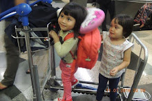
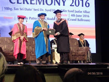


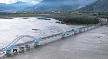
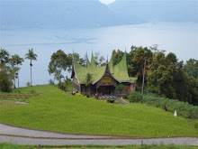.jpg)


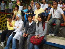
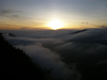

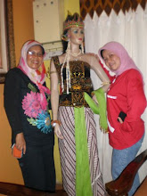
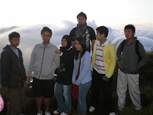
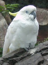
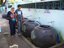

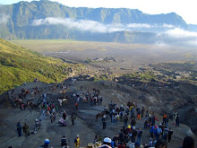


.jpg)
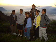
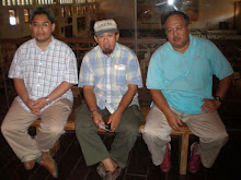
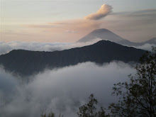
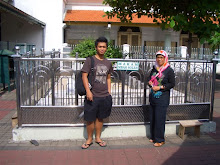
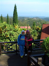
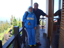

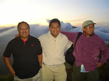
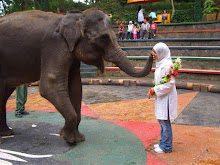

.jpg)
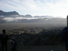
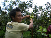

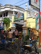

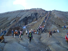
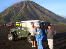


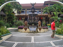
.jpg)


.jpg)